
“…The mountains speak in wholly different accents to those who have paid in the service of toil for the right of entry to their inner shrines.”
Sir Arnold Lunn
All season, my partners and I watched the weather and buoy reports to see if the vaunted El Nino weather pattern would hit the West Coast like we hoped it would. In the Elks of Colorado, we experienced a stellar season by all accounts- consistent storms with large totals and quality snow, which meant that it was possible to get out into the backcountry almost as much as you wanted. As the season went on, and the totals accumulated up north, it looked to us as if El Nino had delivered the goods.
Thus, the call of the wild pulled me back up to Alaska for the second season in a row- this time with an ironic objective to climb and ski Mt. Blackburn, the “King” of the Wrangell Mt. Range in southeast Alaska. I say ironic because I told my girlfriend at the beginning of the season that I wasn’t going to ski much and would concentrate on climbing instead. But the fickle weather gods had other plans, as they often do, and like Johnny Utah and the Ex-Presidents, Joe, Matt, and I had done whatever it took to get up to AK for a chance to ride the ultimate wave.
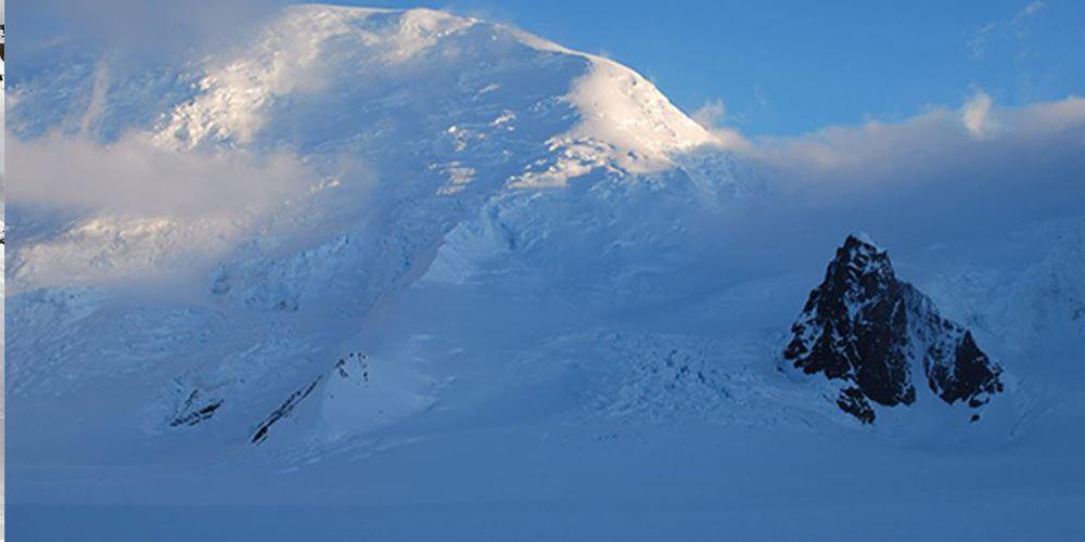
Our team found Mt. Blackburn to be an intriguing mountain for several reasons, namely its size and position juxtaposed with its remoteness. At 16,390 ft, it certainly qualifies as an Alaskan Giant, complete with all of the obstacles that come with trying to scale a skyscraper that far north: massive amounts of glaciation, severe weather, avalanche and serac potential. Not to mention, at some points on the mountain the relief is almost 11,000 ft! The NW Ridge, the typical line of ascent and descent, can have around 7,000 ft of skiable terrain on it. A pretty big wave indeed.
Compared to other mountains in the state, Blackburn tends to a more solitary existence. Matt and I had been to more popular destinations in the Alaska Range and wanted to try to get away from the crowds. With conditions lining up, Blackburn seemed like a great choice. So, after months of planning and skiing to get in shape, the time finally arrived when we landed in the 49th state.
To give you an idea of the remoteness of the Wrangell St. Elias Range, one has to consider how you get there. For starters, you have to drive six or so hours from Anchorage to the remote mining town of McCarthy, AK, home to the incredible Kennicott Copper Mine, now part of Wrangell/St. Elias National Park. You can only accomplish this if the weather is good because once you are off the Edgerton Highway, it is 60 miles of pure dirt road to McCarthy. From McCarthy, you then fly another hour via bush plane to the base of the climb on the Nabesna Glacier. Again, the weather must be good because, unlike flying into the Ruth Gorge or Denali, this flight takes you up and over a 10,000 foot pass flanked by giant rock buttresses. Only one company will do this now and that company is Ultima Thule- an aptly named outfit owned and operated by the legendary Claus family.
Our chariot for the first leg of the expedition to McCarthy was a cherry red Ford Fiesta. The Ford Motor Company, producers of monster cars like the Crown Victoria and the Police Interceptor, humbly state the passenger capacity of the Fiesta at: 85.1 cu. ft. and the luggage capacity at 12.8 with cargo volume behind either row as “N/A”.
While I’m not a superstitious person, when on an expedition, I tend to gravitate away from the rational and become extra aware of events that affect the group. I’m keen to look for signs and interpret them as portents, not unlike a pagan priest before a battle interpreting the natural world into auguries of doom or salvation. So it goes, that with this trip, on such a tight schedule, only two weeks at the end of May (15-30), to try to climb and ski a big peak, known for having some of the worst weather in the world, I wanted, no, I needed good signs coming at me from all angles… And up rolls all 100 cubic feet of cherry red Fiesta in which we must fit three dudes and two week’s worth of gear, food, and fuel for one of the most remote ranges in North America. The resulting gear burial and six hour zero visibility car ride was the only way to make it work. No bad omens here.

Our cheery-red steed that got us to McCarthy-car only half full of groceries.
After arriving in McCarthy to relatively stable weather, we had hoped to fly out later in the day. Unfortunately for us, a dust storm kicked up by the Thule lodge had suspended all air travel. An impromptu dust storm that grounds the team for three dreary days in McCarthy, AK? Still no bad signs here.
Being stuck at the “airstrip,” a gravel runway carved out of the dense Alaskan rain forest, was a mix of Groundhog Day and Insomnia. Each day became a blurring of grey skies and soft, filtered, monotone light and itinerant, drizzling rain. In a town of roughly 28 people, you can literally meet everyone in town, everyday, doing the exact same thing (usually at the bar). The days wore on, with our lofty Alaskan dreams slowly degrading into a substance that resembled wet, glacial till. Our sense of time was beginning to weaken, and if we had had to stay longer in McCarthy, we probably would have ended up like Joe Tasker and Dick Renshaw on Dunagiri, with at least one day that they absolutely cannot account for. We probably would have called those days Mondays.
This was my first experience in being delayed “pre-trip” so to speak and I must say I did not enjoy it. We woke up each day frantically reading forecasts we did not understand, hoping that “today is going to be the day,” craning our necks at any sound of an airplane, real or imagined, and postulating about the weather and how easy it would be to drop us off, all the while armed with the knowledge of armchair aviators and first comers to the range.
To pass the time, we did what any self-respecting Alaskan climbing team would do- we drank liquor, walked around the town looking for more liquor (best way to meet the locals), and finally, found a bar and drank (beer).
On the third day, while walking back from the Kennicott Mine, we saw the clouds begin to lift. Over fifty miles away, we caught our first glimpse of Blackburn. It was bigger than I had imagined and as daunting as anything I had laid eyes on. We rushed back to camp and got on the horn with the Claus family. Indeed, the literal clouds over our heads were dissipating and we would fly the next day. Sobering up took little effort.
The Nabesna Glacier is the largest glacial valley in North America and one of the largest of its kind anywhere in the world. It is impossible to overstate just how remote a feeling one gets while occupying this space. After the plane drops you off, there are no animals other than a bird cast off-course by a storm, no bugs, no other people (if you are lucky), or even planes (for the most part-we think we saw one or two fly over us the entire trip). In sum, there is almost no sign of human civilization- anywhere. This is a unique place, one that has the mysterious mountain allure of total isolation that many of the great ranges in the world have lost or are beginning to lose.
Yet, the ever present forces of nature are hard at work. Throughout the day or night, one can hear the roar of an avalanche ripping down the flanks of Blackburn or its neighboring peak. Where rock faces stood exposed, discerning piles of debris grew at their base, as rocks plummeted from their perches to the glacier below. Small, very blue, beautiful pools began to form after only a few hours of consistent sun. And because glaciers are always moving, we knew that crevasses were constantly forming, widening, and constricting, creating an unpredictable playground.
By the time we landed, it was a perfect day- no wind, no clouds, azure blue skies, and the broiling orb. We said our goodbyes to Jay, Paul’s son, and set to work digging out a luxurious basecamp. Once that was settled, we decided to make the most of the great weather and wand our path up the initial ice fall that guards the entrance to the north ridge. We happily found that our camp was only a half hour skin to the base of the initial crevasse fields and continued wanding and GPSing our route up it.

Matt leading the pack as we wanded our way up through the initial icefall before skiing a minor satellite as the weather closed in.
After doing this, we noticed clouds breaking over the pass we had just flown over and decided to ski off a face of a smaller peak that flanked the icefall. It was a very steep 1,500 ft descent and we found that the snow was consolidated and wind scoured. Despite the less than stellar conditions, we skied back to camp, thrilled to get exercise and to finally live in a throne room fit for the gods.
Going into this trip, we had decided on a certain precaution, that at first, I thought took away the edge of sportiness that I seek when adventuring, but in hindsight, was really glad to have. To combat the predictably unpredictable and fierce weather, we elected to have a satellite phone and hired our friend back home to give us periodic weather reports. The phone call to our friend Tim became a sort of ritual of affliction, solemnly carried out at a prescribed time, every few days when we would note a break in the weather. As we consulted the oracle each time, we hoped that good news would flow over the phone and thus drive away the malignant spirits responsible for our apprehension and frustration. After a few days of being storm bound and only able to execute small, warm up missions to the surrounding small peaks, we began to think that we saw a pattern in an otherwise chaotic mess of air and precipitation. As it was shaping up, despite what the weather forecast said for the area on Tim’s end, after a day or two of storm(s), our side of the peak generally saw a stable period of weather lasting anywhere from 6-15 hours. This was our chance!
Our plan for the summit was simple and had been time tested by other climbers and skiers. After navigating the initial ice field, we would make our way up to about 9,800 ft, essentially where the ridge starts, and fire the ridge in a single, lightweight, alpine style push and then ski back down the way we came (hoping to be up so fast AMS would not set in). When we saw the typical line up of storms coming, we assembled all of our gear, brought food and fuel for two days, and trudged our way up the wanded path to our destination.
Unfortunately for us, the traveling weather proved quite brief and we navigated our way up in a complete white out. The good thing about this spot is it sits below the NW and N. Ridges, but the bad thing about this spot is it sits beneath both of those ridges. In the moment, it was hard to tell how far away we were from potential avalanche runout. We knew that it was possible to get pretty far away, but too far and you were off a cliff or into a gaping crevasse “into the void” style. Using a mixture of GPS and old-fashioned compass and map navigation, we settled on a spot and dug in. By this time, the wind was starting to really come up and the snow was flying. But this was good, this was the plan. After the storm, we were confident stable weather would follow. That night we stayed up taking turns digging out the tent. The storm was unrelenting and the sound of avalanches around us grated at our nerves.
We underestimated how much worse the weather was at 9,800 ft than tucked safely away on the Nabesna at 6,800 ft. In the morning, as the snow continued to pile, we elected to abandon the plan and head back to basecamp, as we were afraid conditions would further deteriorate and we could potentially get stuck. Once again, the map and compass came out and at a painfully slow pace, we found the wands that hadn’t been buried.

The team retreats from advanced basecamp back down to basecamp in typical conditions on Mt. Blackburn.
We made it back to basecamp by midday only to watch as the snow stopped flying, the winds calmed, and the clouds lifted. By late afternoon, the weather was perfect. Calm, clear, blue. I don’t tweak easily, but this tweaked me something good. Of course, by this time, the mountain had acquired a near demonic persona that was relentlessly mocking me. There was nothing to do but unpack, cook food, and dry out the gear. I set my stopwatch.
This episode clearly called for more divination from the oracle. Unbelievably, we actually got a forecast that we were excited about. So much so, that we elected to repack in the early hours of the morning and trudge right back up to Advanced Basecamp. None of us really felt like sleeping, so we just decided to repack. As we were doing so, we saw clouds start to build and sweep the NW Ridge like we had so many times before. The window was closed; I looked down at my watch, it had only been eight hours. Jay’s words echoed in my head “Whatever you do, do not get stuck on that ridge.” We would not have made it if we had stuck to the plan.
We fired back up to our high camp with enough speed that we could see the location of our old camp. It actually was not in a terrible spot, but we could and would do better this time. Secure in our knowledge that it would basically take the whole mountain coming down to get us, we were able to sleep a little more soundly as a storm swelled over us once again. This time we were better prepared for handling and deflecting the ravages of the storm. Like the surfer who turtles below an impending wave instead of getting thrown into the washing machine, we had plenty of food, fuel, and games to keep us occupied. After a day or so, at around 9 a.m. we heard what we had spent the entire trip listening for. This is not a sound itself, but rather the absence of the whirling of the wind. With that, we were up and could already start to see patches of blue beginning to break through the grey clouds.
Overall, the NW Ridge is considered to be a moderate climb by Alaskan standards, with a given rating of II or maybe II+. I think that overall, this is probably a sand-bagged grade, but for some, on lucky years, this is probably the case. On a Grade II climb, you can hope to find somewhat steep slopes, mild crevasse management and little to no technical ice climbing. Despite stellar snow and crevasse conditions, the NW Ridge as a grade II was wishful thinking for this trip. First, we immediately recognized that there was not a ready way to access the ridge. An improbable double-cornice feature prevented the easy walk-on approach we were hoping for.

The improbable features preventing us from quickly advancing onto the NW Ridge.
Rather, we had to go left and look for a ramp that was way up the ridge- we had seen it on the flight in. This meant lots of unprotected snow traversing under huge Jaws-like cornices, big waves frozen in place. It also meant a few pitches of 70+ degree ice climbing-solo. Despite these difficulties, we made great time and finally crested over the ridge, only to find a massive bergschrund blocking our path, More traversing and backtracking ensued until finally we were up on the ridge and the angle eased off tremendously.
Despite the weather holding for the initial part of the ascent, as I crested onto the ridge, I looked up into a giant sun dog, or parhelia. Apart from huge storm clouds coming out of the south, this was about the worst sign I could imagine seeing. Ice crystal halos, especially in warmer months, portend impending precipitation (what we had coined as “The Evil” on our trip) and in our case, we now knew we had limited time until The Evil caught us exposed on the ridge. Still, there were no clouds to be seen anywhere, just the lofty peaks of almost innumerable summits and the ocean beyond. It was still a spectacular day and if clouds built, we reasoned, we would turn it around immediately and ski down, now that we were on the ridge.

Grade II was a pipedream on our attempt- Matt and Joe navigate steep snow and ice. Note the beginnings of the sundog- the rainbow arc to the right of the sun.
The scale of Alaska is something that one cannot truly train for, since it can only be experienced and appreciated in Alaska. We were on the ridge, somewhere above 13,000 ft and had a few miles of easy skinning to go to nab the summit. Needless to say, we underestimated how far we had to go and how long it was going to take. By the time we reached the summit, a cirrus cloud was hanging over the top and it was around midnight. We all felt like shit and were individually hoping that we wouldn’t show enough signs of AMS that our partners would turn us around. Experiencing slight AMS as I did, I can say it was quite unpleasant and to borrow a phrase from Paul Pritchard, “one for the collection.” After the requisite hugging, high fiving, and terribly-shot summit photos, we ripped skins and buckled up for the descent. The weather held.
I had not skied at night since I was a kid growing up in upstate NY. There was something really exciting back then about skiing at 9 or 10 p.m., even if under the glow of giant, artificial lights- as if you were doing something you knew was wrong, which amplified its pleasure. In this moment, we were skiing in the gloaming of a sun that never sets amidst one of the largest National Parks in the world on a 9,000 ft run. At the top, you tower over everything around you and all that is around you are huge peaks and vast glacial valleys. The low light casts a softness on every edge that creates a stillness and calmness that is nearly impossible to replicate. It is the absence of things, people, trees, and noise that gave the run a surreal feeling. I can only compare it to being on the bowsprit of a ship, laying face up at the impossibly starry sky, gently lulled by the stirrings of an ocean with no wind. Unlike the ocean, a great void exists on either side of us as the mountain drops off precipitously; it is easy to stay the course down the spine. While wind jacked and scratchy for the first 500-1000 ft, the hardness gave way to overboot, soft powder and we began to arc big turns as we skied back to our wanded entry point, whooping in exultation as more oxygen returned to our brains and lungs. Having seen the snow on the NW Ridge from above, we had elected to ski the North Ridge proper on the way down.

The approximate line of ascent in red and the approximate descent line in green.
Breaking from the traditional and safer approach of “skiing what you climb,” based on photos and snow we climbed, we felt like this would be a more fun and challenging option. We knew it was going to be steep, but judging by the more protected areas we had climbed, we thought we were going to be skiing deep powder. We were not mistaken. We had a few more thousand feet of some of the steepest and deepest powder I have ever skied, jumping bergs one at a time and getting face shots, straight down the North Ridge. With about 2000-3000 ft left to the icefall near our camp, the skiing turned much more technical as the deep powder gave way to some bare ice and no fall zones. Despite a wrong turn or two which necessitated climbing back up the face, Matt finally yelled, “FOUND THE WAY OUT AND IT LOOKS SICK!” and without much adieu, we traversed over and watched as Matt jumped the final berg and skied through knee deep powder all the way back to the flat field near our camp. I was the last to ski the line and somehow I skied it well, mustering up the last reserves from an already empty tank, down the shoot, over the lip for a straight shot right into the exhausted arms of my laughing friends- the best sign of all.